Story Highlights
- Earth and Environmental Sciences professor Christopher Scholz digs deep into the geological past in his research on Africa’s Great Rift Valley lakes.
- In an expedition on Lake Malawi in early 2024, Scholz and his research team collected geophysical information on the lakebed and sediment beneath it using sophisticated technological tools.
- Graduate students on Scholz’s research team are analyzing and integrating the new information with previous research to gain insights on past seismic activity, the lake’s faults and how they responded to changes in lake level over time.
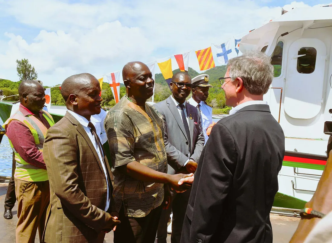
Professor Christopher Scholz greets Malawi’s Minister of Lands, Hon. Deus Gumba, at the re-launch of the R/V Timba on Lake Malawi in January. Also present are Malawi’s Surveyor General Masida Mbano (second from left), as well as the Principal Secretary of the Ministry of Lands Davie Chilonga, and Capt. Peter Limau of the R/V Timba (dress white uniform). Lake Malawi is approximately 360 miles long, 2,300 feet at its deepest point and bordered by Malawi, Mozambique and Tanzania. The lake is home to more than 800 species of cichlids (popular aquarium fish), most of which are found only in Lake Malawi.
Christopher Scholz has investigated the geological history of Africa’s Great Rift Valley lakes for nearly four decades, gaining valuable insights on past earthquake activity, fault behavior and climate change in a region known for its biodiversity and role in evolution. “These places are model environments for evolutionary biology—and they’re forced by the geologic processes that are operating there,” says Scholz, a professor of Earth and Environmental Sciences (EES) in Syracuse University’s College of Arts and Sciences. “Homo sapiens evolved on the margins of these lakes, so the lakes’ histories are really important for understanding our own origins.”
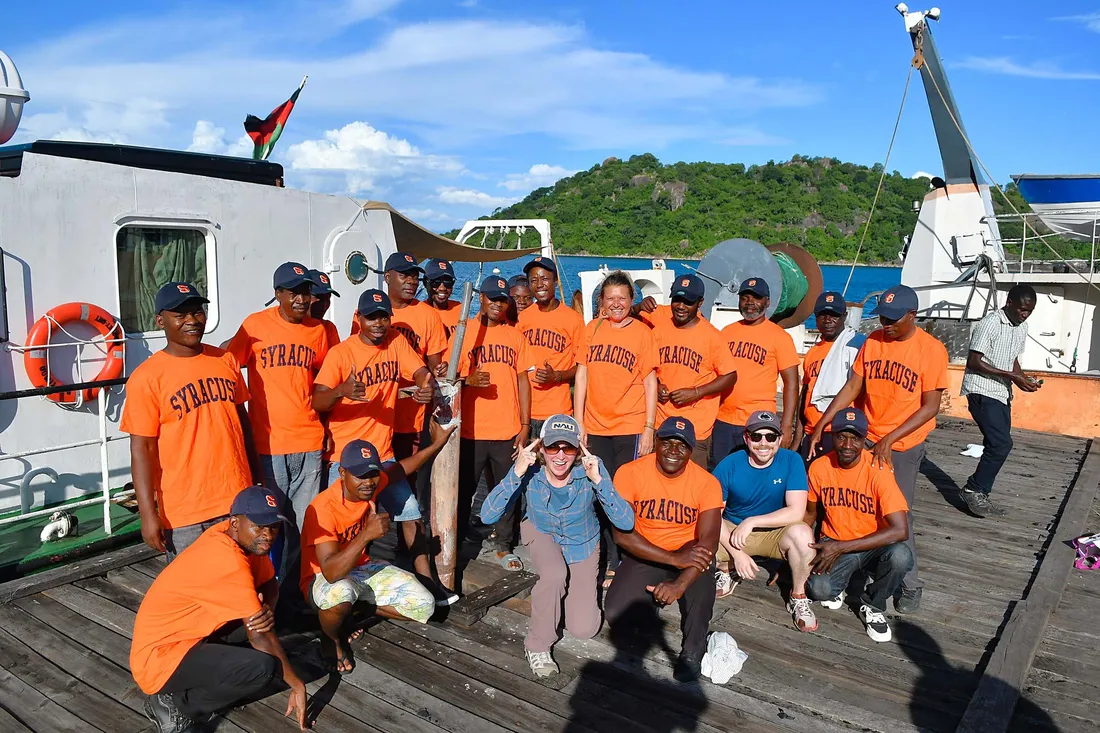
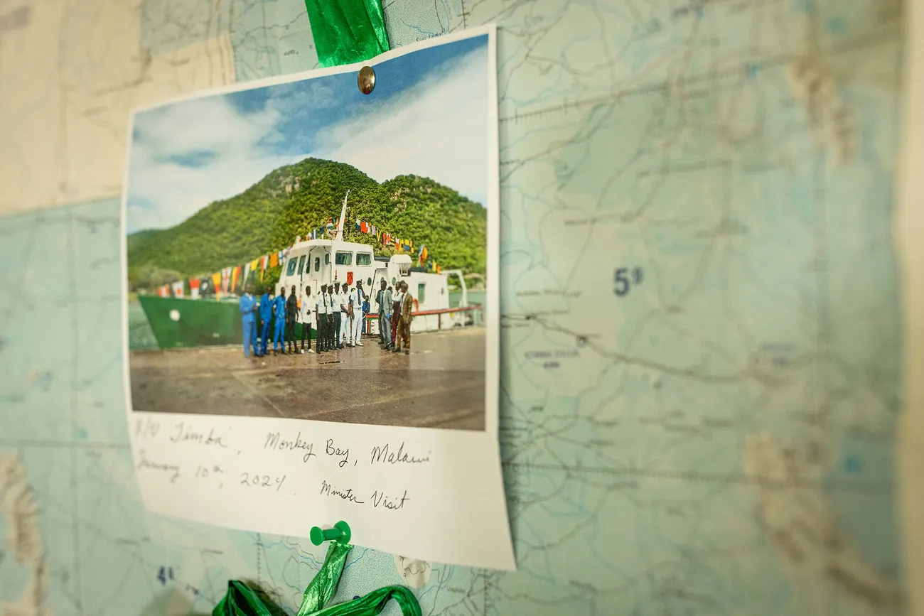
At the port in Monkey Bay, Malawi, the R/V Timba crew show off their Orange spirit, sporting Syracuse hats and T-shirts that they received as gifts from Professor Scholz.
In his latest expedition, Scholz led an international research team studying Lake Malawi, one of the world’s oldest and largest freshwater lakes. It’s also an ideal site to explore active continental rifting of the western branch of the East African Rift System, where two tectonic plates have been pulling apart for millions of years. “We see active faults in many places on the floor of the lake and that’s because Lake Malawi covers almost the entire Rift Valley in that part of East Africa,” says Scholz, an expert on paleolimnology and rift basin evolution.
Mapping the Lakebed and Sediment Beneath It
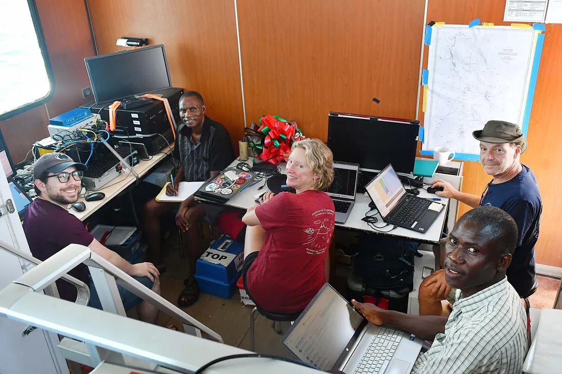
Members of the research team monitor real-time data they receive from their sonar CHIRP system and multibeam echosounder. Pictured (clockwise from left) are Syracuse doctoral student John Greenlee, Gift Chigona from Malawi’s Hydrographic Surveys office, Northern Arizona University (NAU) professor Donna Shillington, Syracuse research analyst Douglas Wood and Patrick Chindandali, geophysicist with Malawi’s Geological Survey Department and graduate student at NAU.
The team—which includes graduate students and scientists from both Syracuse and Northern Arizona University as well as Malawi’s Geological Survey and Department of Hydrographic Surveys (DHS)—spent time in January and February surveying part of Lake Malawi aboard the R/V Timba, a research ship owned and operated by the DHS. The research was enhanced by two sophisticated technological tools: a multibeam echosounder, which mapped the lakebed’s depth and shape in swaths as wide as 2,000 feet; and a sonar CHIRP system, which provides seismic reflection images of lake sediment far beneath the lakebed. Both tools use acoustic energy to provide information and are typically used in ocean exploration. Over the years, Scholz and his team have adapted marine geological and geophysical methods to operate on freshwater lakes around the world.
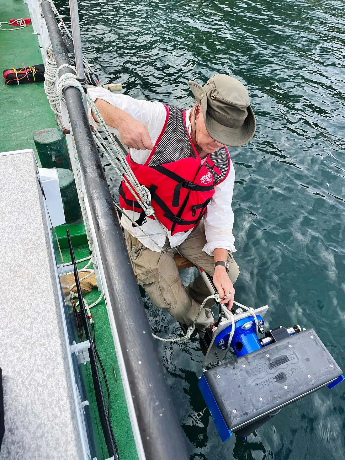
Research analyst Douglas Wood positions the multibeam echosounder off the side of the R/V Timba. The instrument emits “an acoustic ping in the water that goes down, spreads, hits the lakebed and bounces back,” he says. “You end up with a swath of many data points on the order of about three and a half times the depth of the water.”
The echosounder’s high-resolution imagery displays geological features like canyons, channels and intrarift faults, and the data reveal the length of the faults, their surface ruptures and their offsets over geologic time. According to Scholz, the lakebed mapping also provides the Malawian government with information on water depth for approaches to its ports and for its fisheries department. The team—whose research is supported by a National Science Foundation (NSF) grant—is integrating the survey information with analysis of sediment core that Scholz collected in a 2005 drilling project on Lake Malawi (also known as Lake Nyasa) and computer modeling performed by EES associate professor Robert Moucha and EES research assistant professor Liang Xue. Pieced together, the information will allow the researchers to “reconstruct fault geometries and slip rates over hundreds of thousands of years, evaluate controls on why particular faults are active and estimate past earthquake activity,” says Scholz, noting a series of earthquakes in 2009 that rocked Karonga, a town on the lake’s northwest shore. “That’s the next step in this project: Can we model past seismicity on these intrarift faults that we imaged so nicely?”
Digging Into Data From the Deep
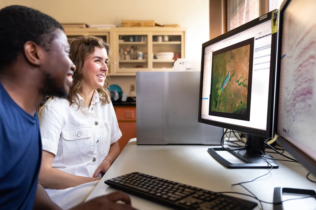
Doctoral student McKenzie Brannon (right) and visiting scholar Donatien Ishimwe view a map of the Great Rift Valley.
EES doctoral student McKenzie Brannon joined Scholz and research analyst Douglas Wood, who oversaw the high-tech equipment, in Malawi as they prepared the Timba for the research survey. For Brannon, the trip was a “huge adventure,” providing an international cultural experience as well as the opportunity to work with the multibeam echosounder, which Scholz acquired through support from the University and the NSF. Brannon, who had previous experience using sonar for seismic profiling, spent about a week on the water, taking shifts to monitor the equipment. “The data comes in real time so you can see right away what you’re finding, which is neat,” she says. Brannon also appreciated learning from Scholz about all the planning, organization and work involved in managing the project. “There are so many moving parts to put together a project like this,” she says. “Hopefully I took away some skills.”
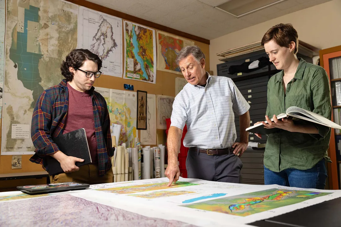
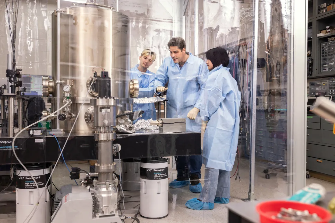
Professor Scholz reviews geological information on a map of Lake Malawi with doctoral student John Greenlee and Laura Streib, who earned a doctorate in the spring.
In Scholz’s Basin Analysis lab, graduate students work on several projects connected to Rift Valley lakes. EES doctoral student John Greenlee, who participated in the Lake Malawi survey, demonstrates on a computer how he uses the integrated information visually to select a fault in the lakebed and view the corresponding seismic information in individual layers across time periods. “I did that across multiple faults all the way back to about 1.3 million years,” Greenlee says. “We’re mapping the slip rates of different smaller faults and comparing them over time to our record of the changes in the lake level and seeing how the faults responded to those changes.”
In analyzing the 2005 Lake Malawi sediment core—“a tape recorder of climate change,” Scholz says— their research hit a snag as different age-dating methods gave them different answers in the middle section of the core. Laura Streib G’24, who completed her EES doctoral work this spring, made a breakthrough using a technique known as luminescence dating, which reveals how long ago mineral grains in the sediment were exposed to sunlight. “The amount of luminescence that’s released relates to how long it was buried—or in the dark,” she says. “We can also see that our record with our new age model matches sea surface temperatures super nicely.” Amid her research, Streib also discovered a new species of diatom (microalgae) in the sediment core. “They tell us about the amount of nutrients in the lake, and we can associate that with how much precipitation the lake got or how high the lake level was,” she says.
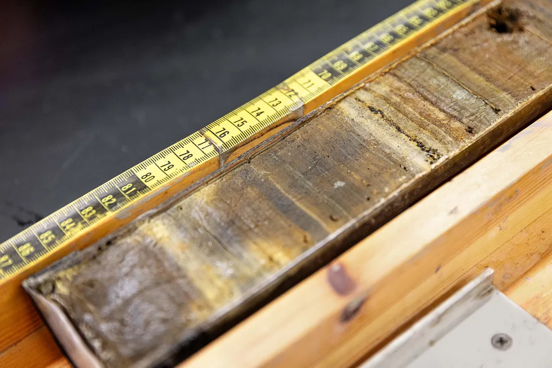
This sediment core, taken from the East African Rift Valley, contains a wealth of information that Scholz and his graduate students use in their ongoing research.
Scholz and his team will continue to analyze the data and publish peer-reviewed research on their findings over the next several years. They also look to connect their data with data from modern seismic events, which may help them determine which earthquakes are associated with particular faults. “We’re really focused on the faulting history and seismicity, but the broader scope of our research group is very much involved in understanding past climate histories in the tropics,” he says. “There are prospects for some high-profile results to come out. I can’t predict when that will happen, but we’re excited about what we’ve collected.”